There seem to be hundreds of historical markers in Arlington, Virginia, which I guess is not that surprising — this area is full of history and interesting stories. I’m trying to collect all the historical markers I see here.
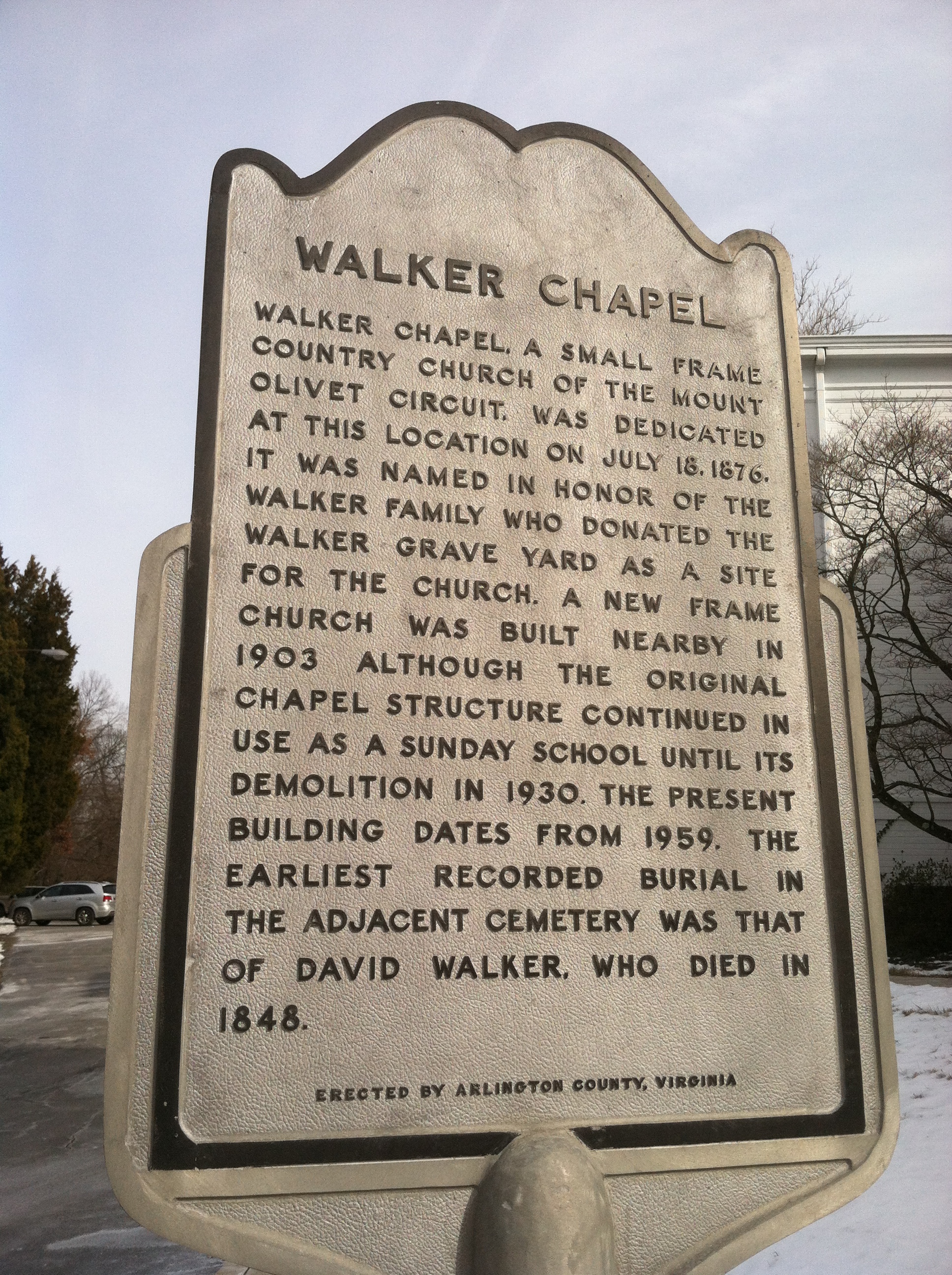
Walker Chapel
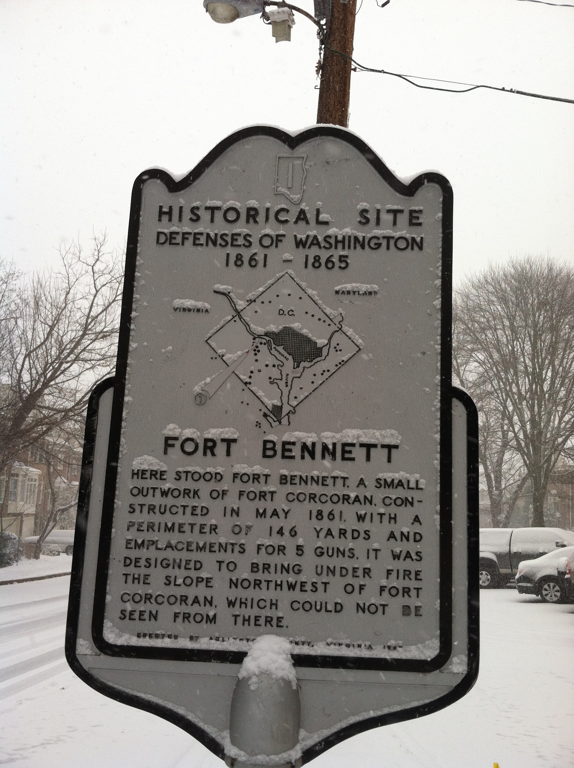
Fort Bennett
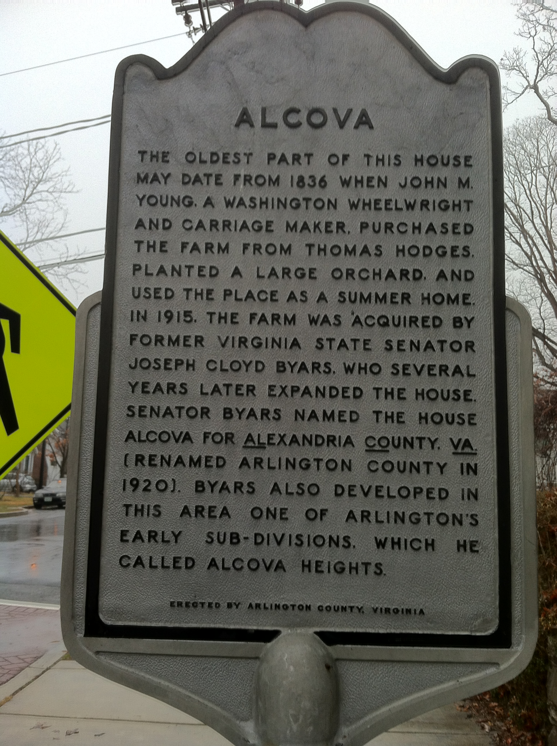
Alcova
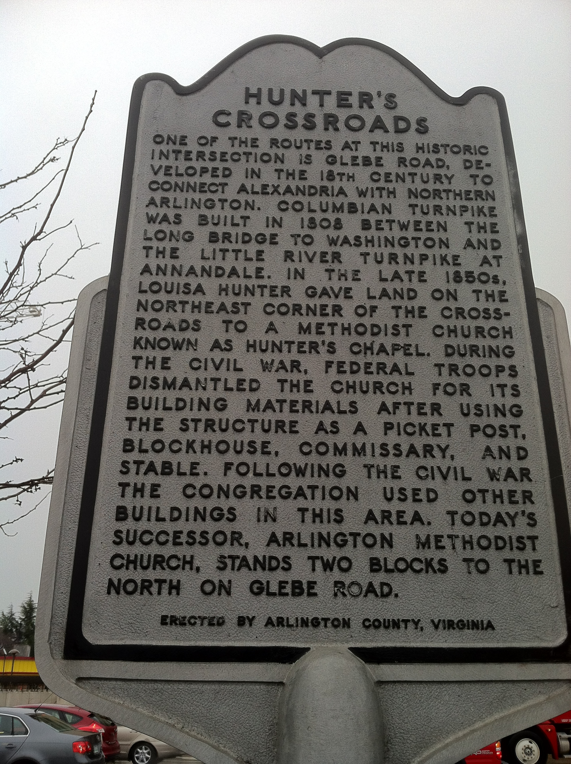
Hunter’s Crossroads

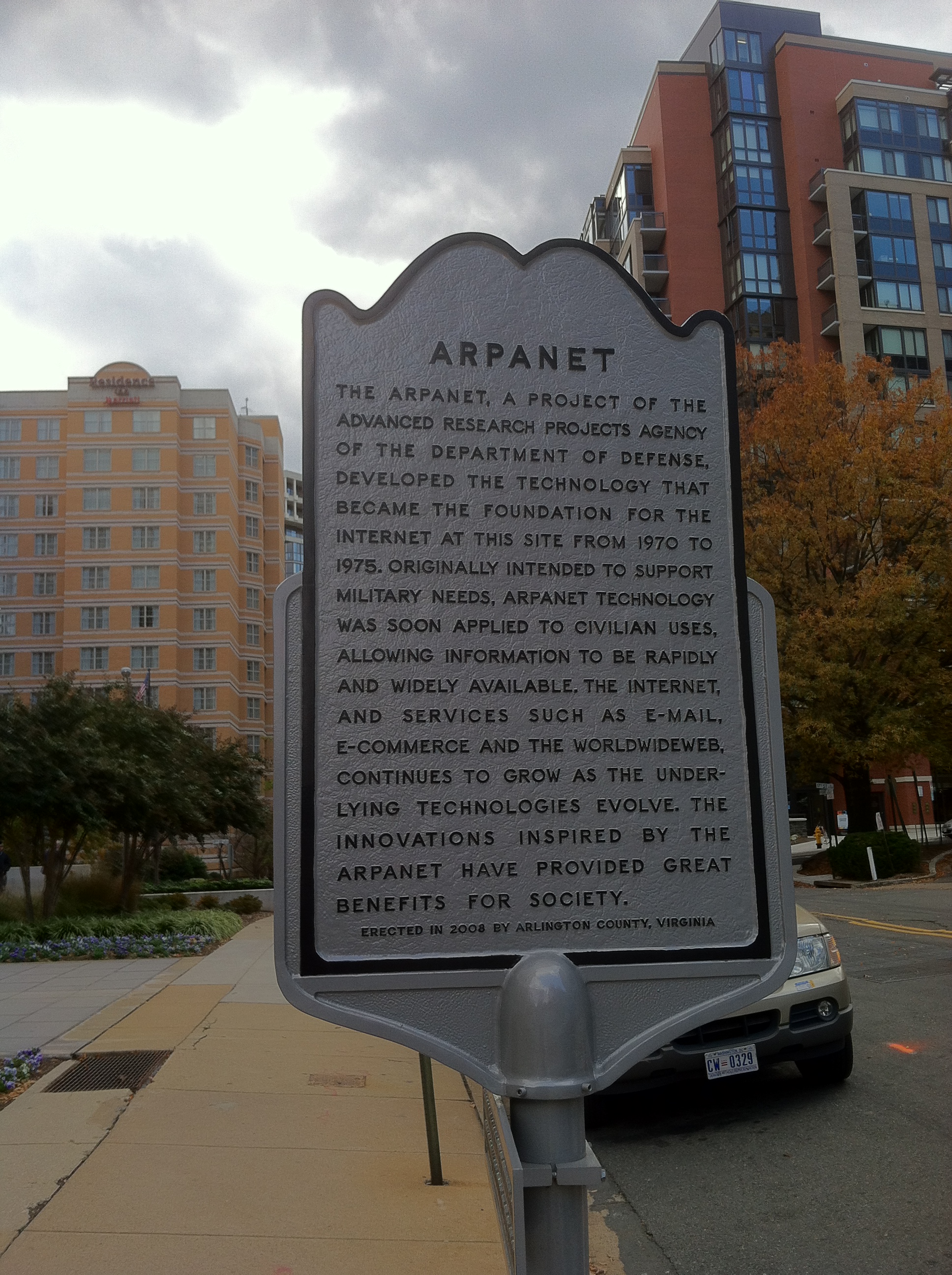
Arpanet, the precursor to the Internet, right here in Rosslyn

The Saegmuller Public School was in use from 1890 until 1937
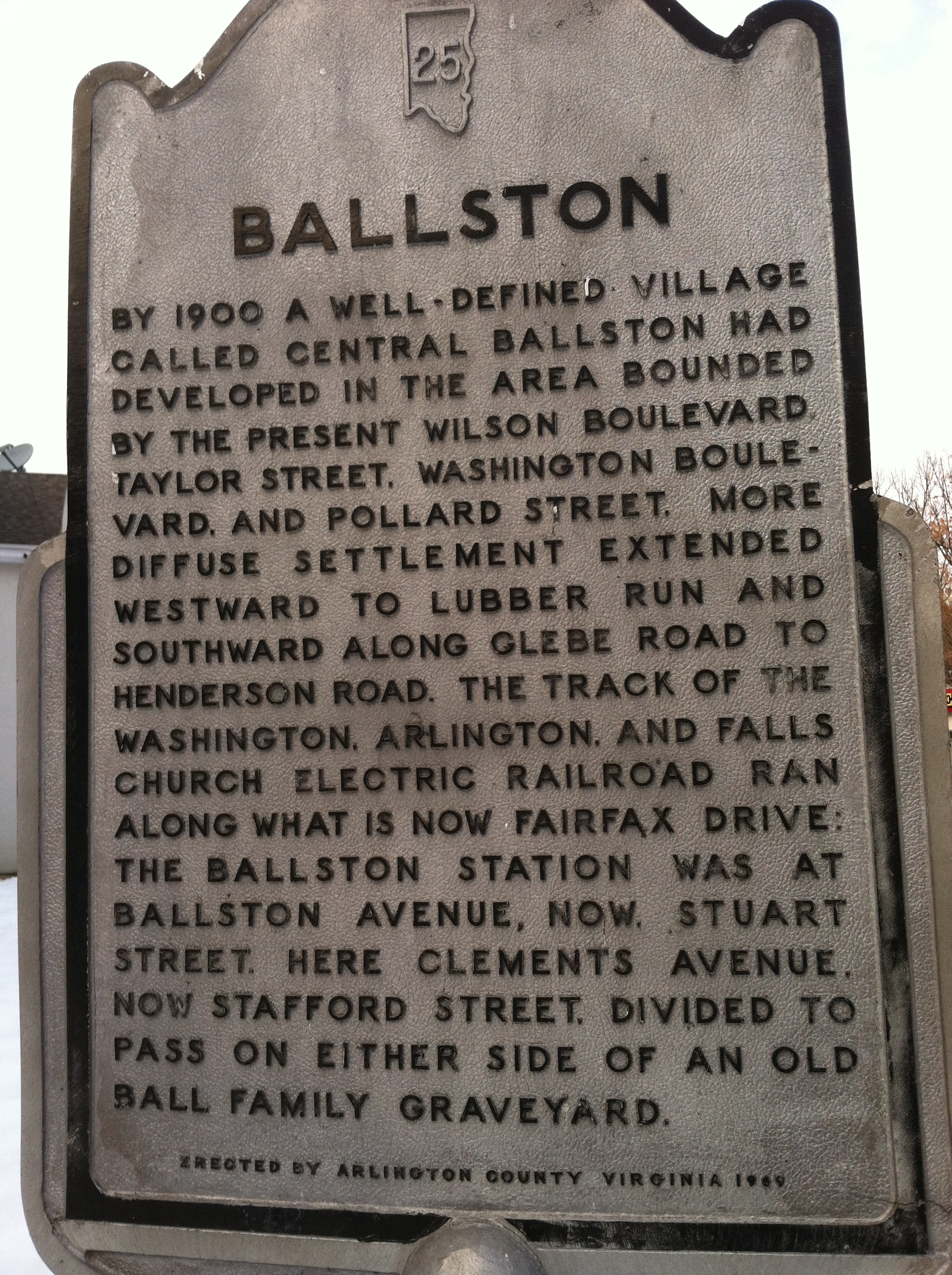
Ballston

The Ball-Carlin Cemetery
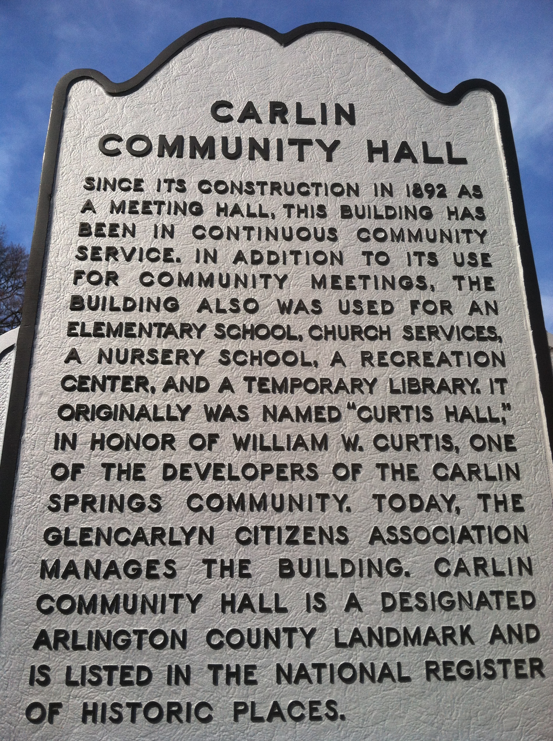
Carlin Community Hall
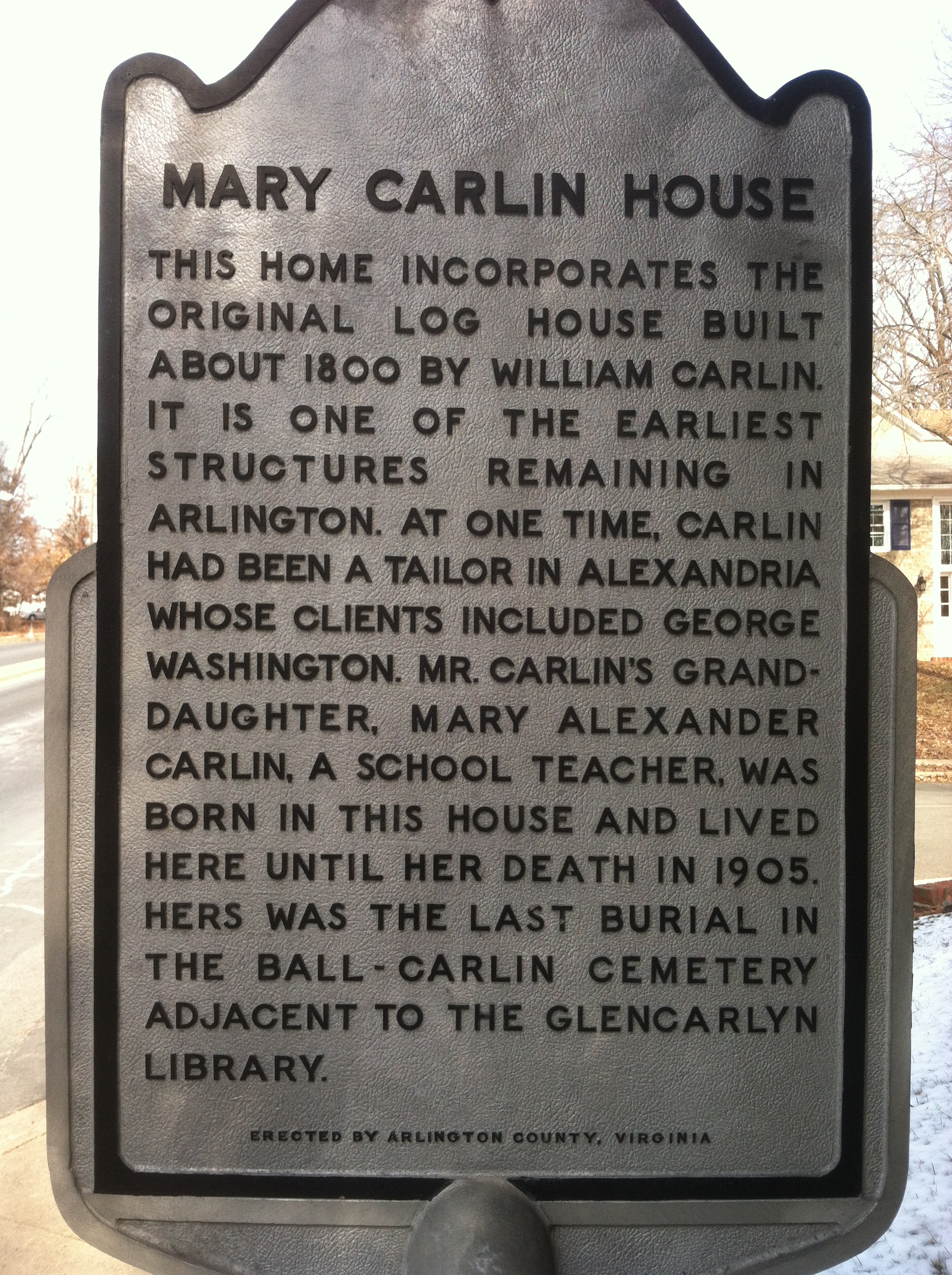
Mary Carlin House
Mary Carlin House

Chain Bridge — northernmost marker in Arlington?
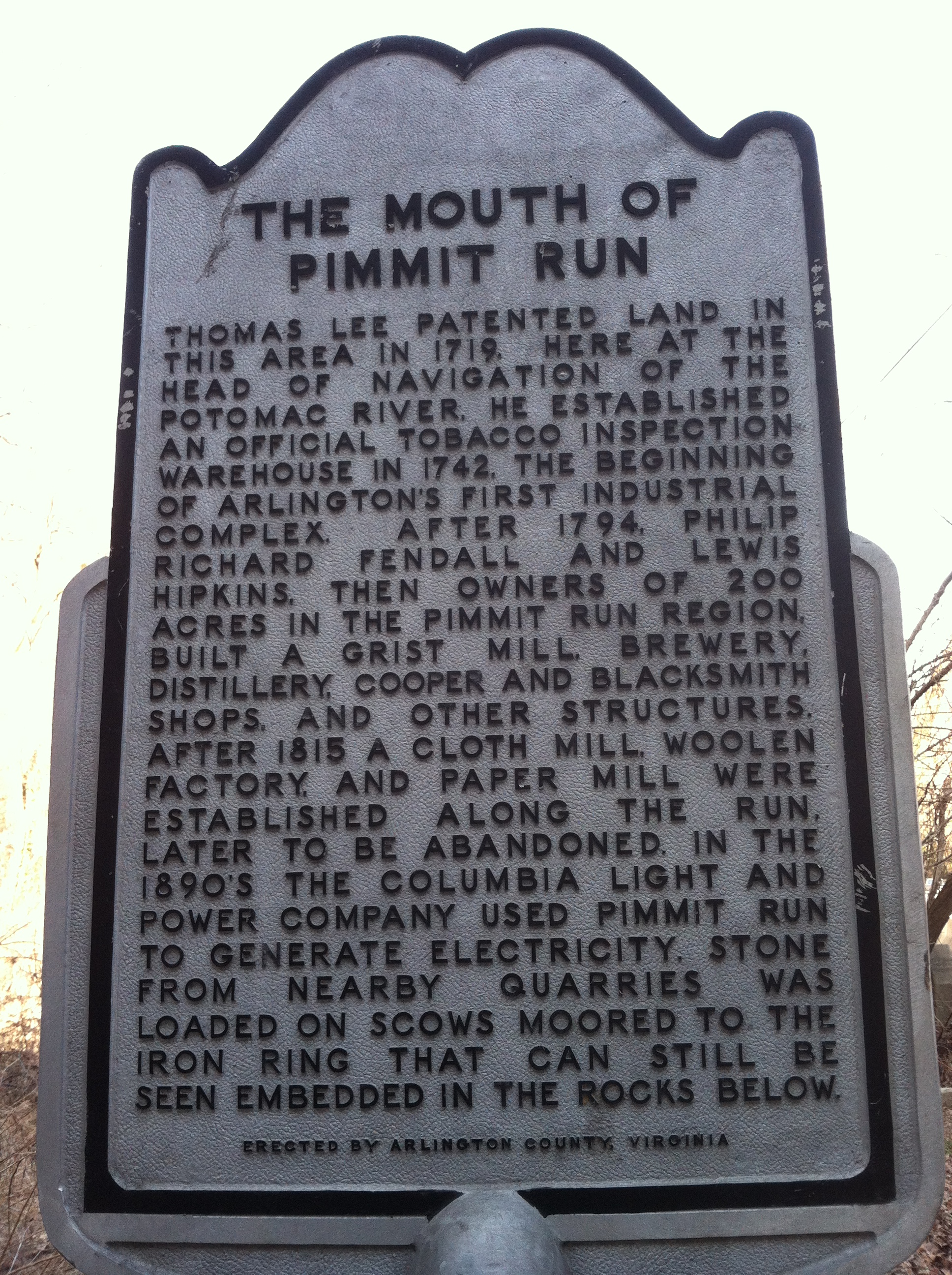
Mouth of Pimmit Run
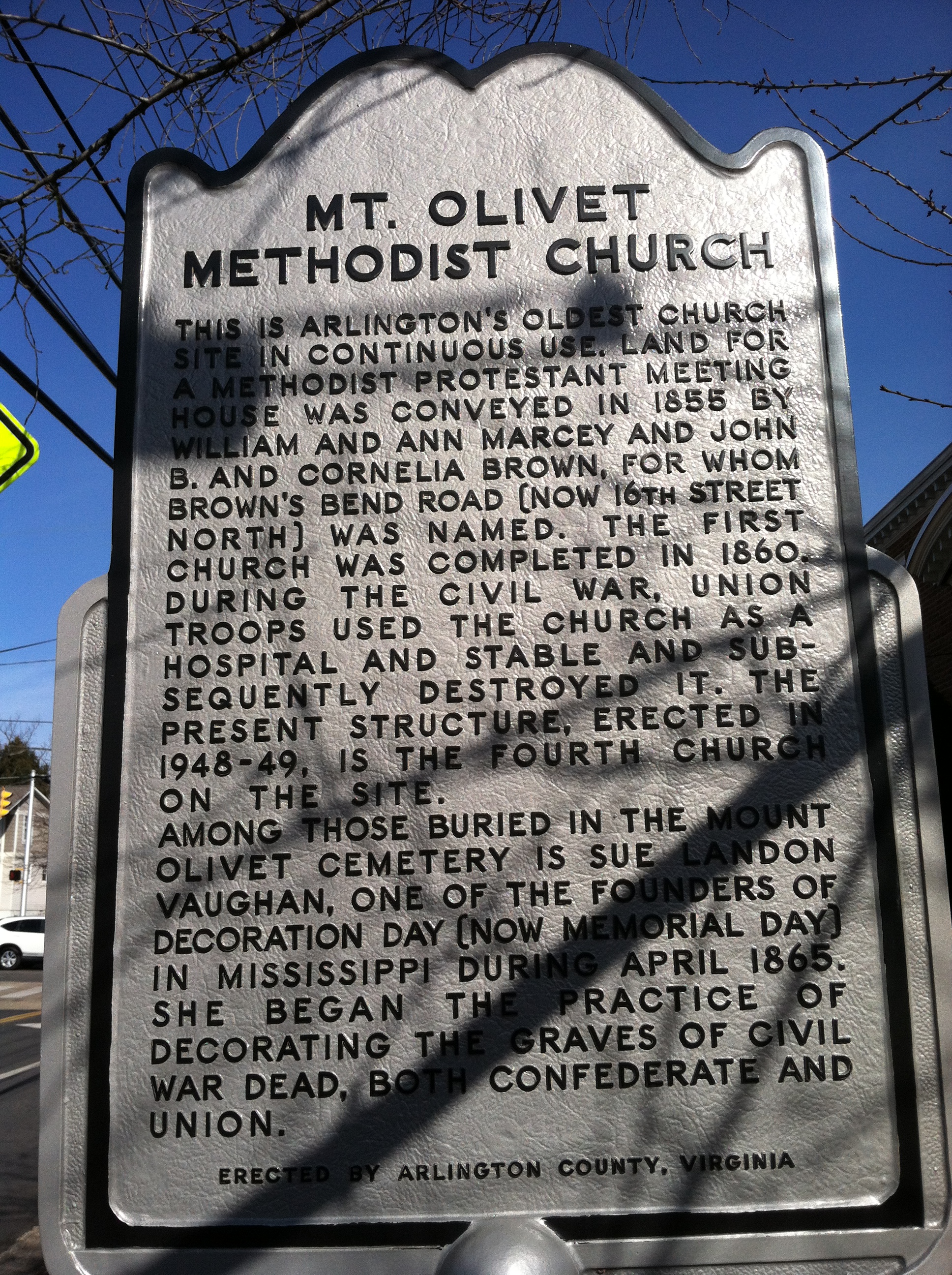
Mount Olivet Methodist Church
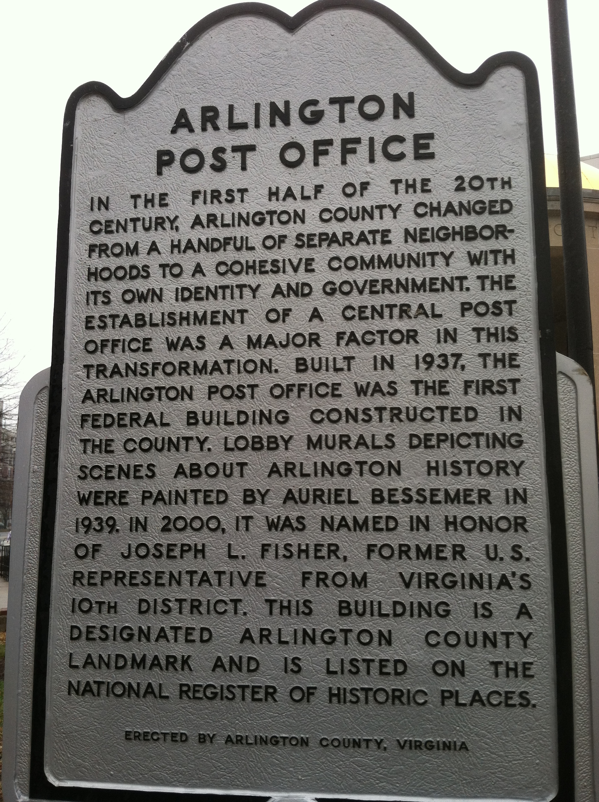
Arlington Post Office on Washington Boulevard
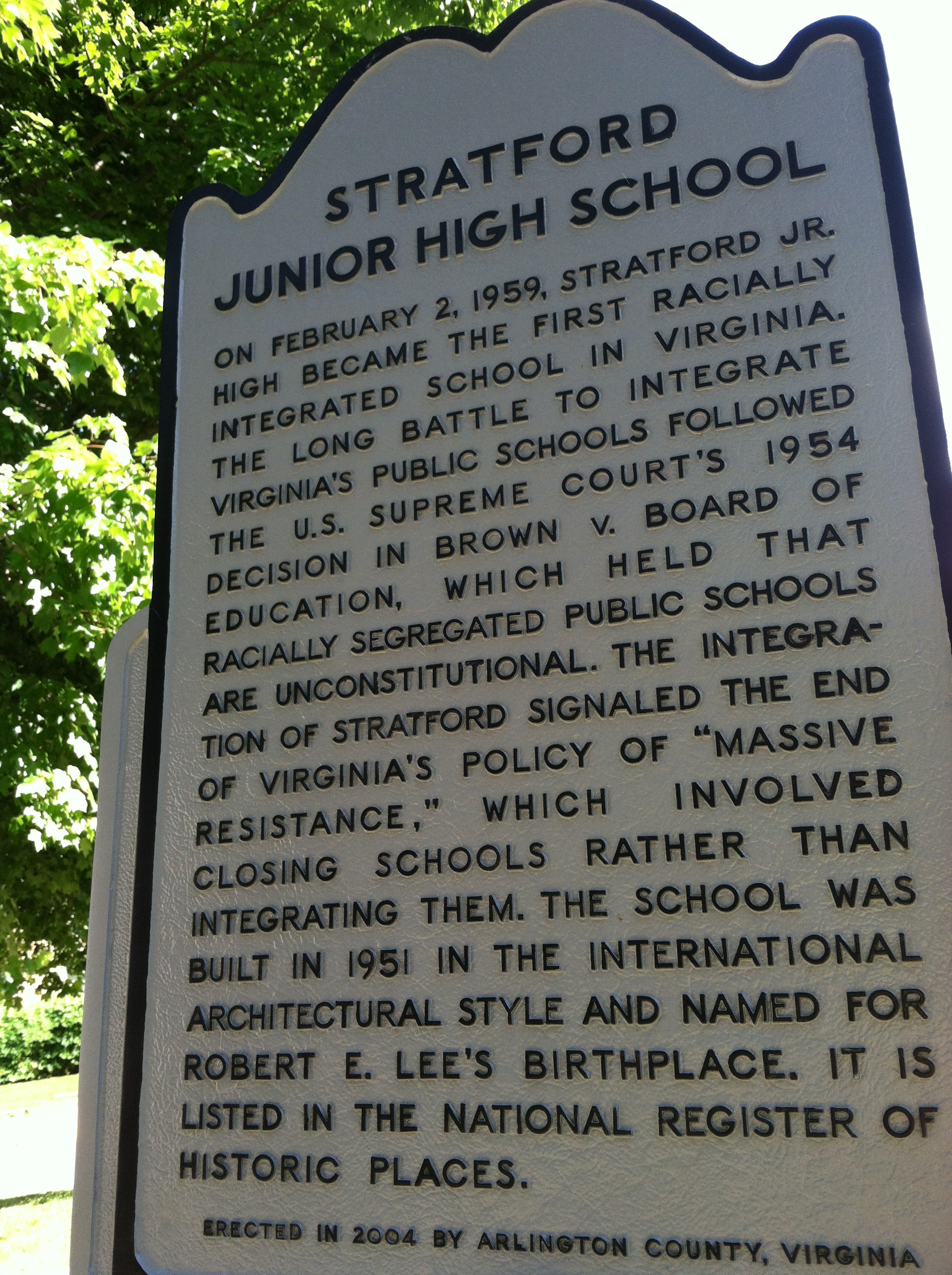
Stratford Junior High School (currently H. B. Woodlawn school)

Minor’s Hill
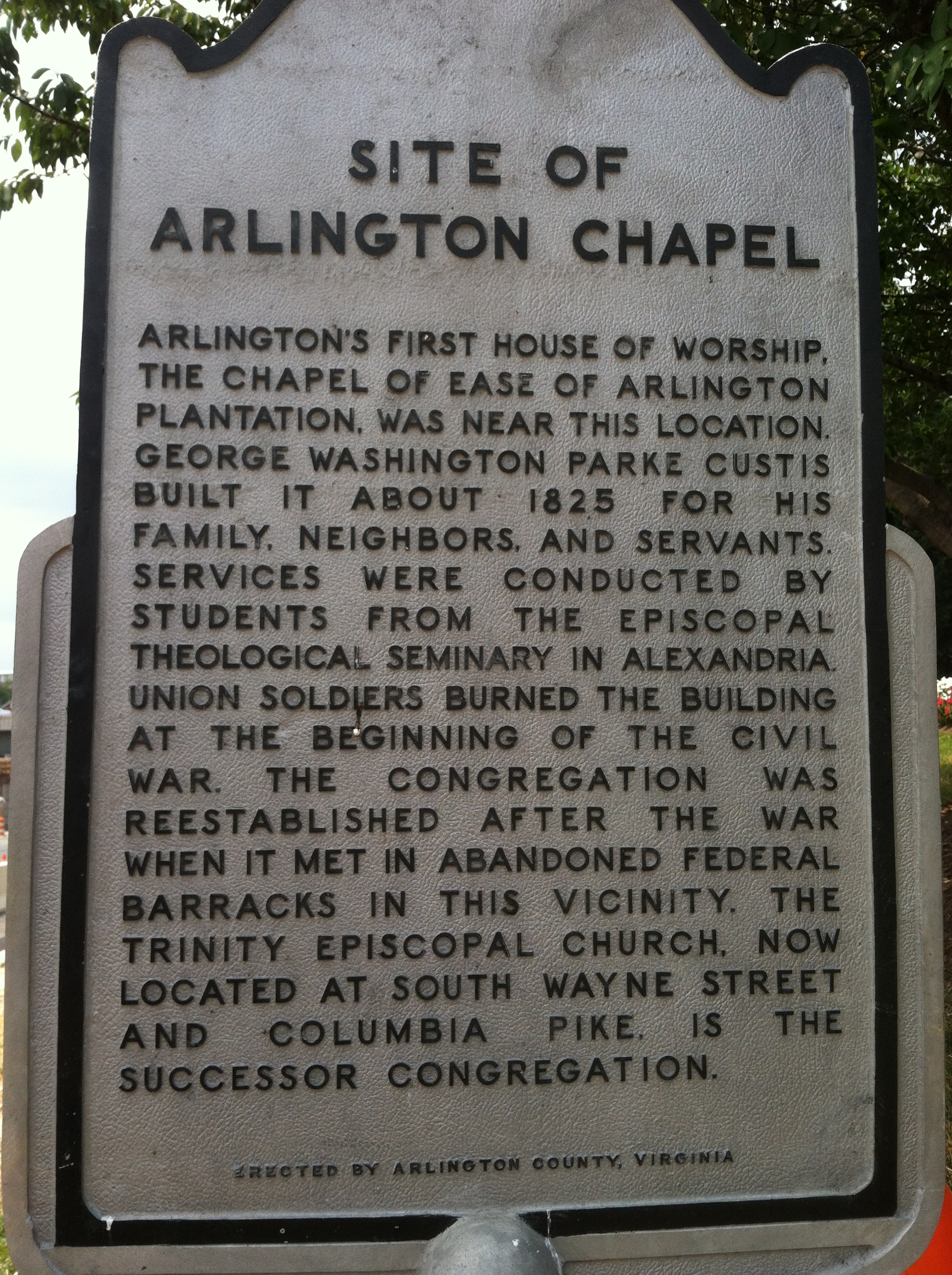
Site of Arlington Chapel
I’ve been exploring the eastern end of Columbia Pike where are several interesting neighborhoods. I spotted this historic marker for Site of Arlington Chapel several times next to the hotel, but today I finally stopped and got a picture.

Fort Albany marker on Arlington Ridge
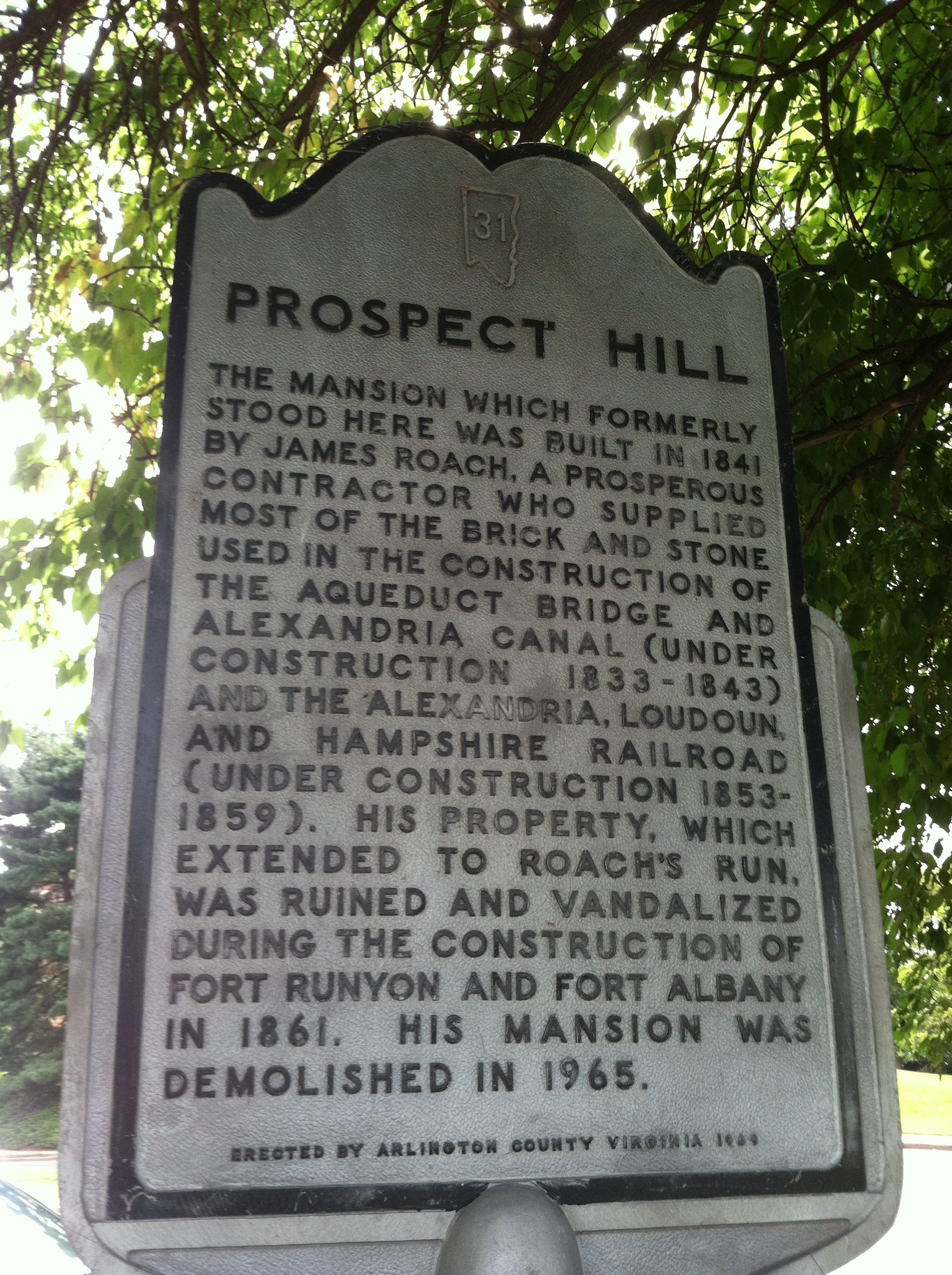
Prospect Hill marker on Arlington Ridge